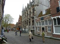
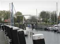
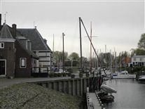
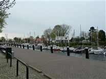
Photos_-_1148.jpg
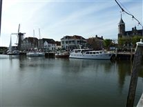
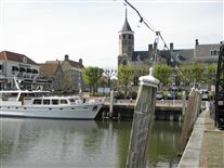
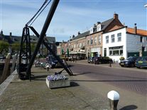
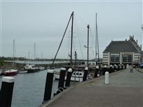
Willemstad harbor - Click 'Details' for more information
Driving toWillesmtad across the green flat landscape, it is hard to imagine that all this land used to be a muddy marshland which was often flooded by the sea, but until the 16th century this was the case. It was used by shepherds who lived on artificial dwelling mounds to protect them from high water.
The land was owned by a marquis who decided to turn the area into a polder in 1564 after several other areas in the region had been reclaimed. This resulted in a piece of land called Ruigenhil and in 1565 a town of the same name was built there. The town consisted of three parallel streets with a big square graveyard at the end of the middle street. This pattern is still visible today.
In 1583 the Spanish took the town of Steenbergen situated just south of the new land. According to William I of Orange
William I of Orange (1533-1584) was a leading figure in the Dutch Revolt against the Spanish and the start of the 80 Years’ War, resulting in the declaration of independence of the northern provinces. William of Orange was assassinated in 1584.
‘this formed a threat for the rest of the Netherlands and he decided to fortify the village of Ruigenhil.
Looking along a curtain wall (left) towards a bastion (centre).
William came into possession of the town after the new marquis took sides with the Spanish in 1567 and was discharged of his possession. As a dispensation for all the costs of the war William was declared the new marquis by the Dutch state.
One of the bastions flanking the entrance road.
The position of Ruigenhil was a very strategic one; right on the border between the southern and northern Netherlands along one of the most important Dutch rivers – the Maas. Abraham Andriesz (an prolific military engineer in the Netherlands at that time) designed the fortications in 1583.
In 1584, the same year William I of Orange died, the city was renamed Willemstad in his honour. In 1609 a twelve year long truce was signed between Spain and the Netherlands.
As a consequence of this the discharge of the old marquis in 1567 was declared illegal and the lands had to be returned. Willemstad remained in the hands of Maurits (William’s son) because William fortified the town (according to the treaty the parties had the right to keep the towns they fortified).
The fortifications of Willemstad and the windmill on the ramparts.
From that time on Willemstad has always been an estate of the crown, giving it special rights and a certain amount of independence. The fortifications have changed over the years in accordance with updated fortification theories and the overall form of the current fortress dates from the 1680s.
A bastion, showing a retired flank.
The fortifications were designed according to the Old Dutch System, only here the flanks of the bastions
A bastion is a pentagonal work that projects outwards from the main wall. Cannon in the flanks could cover the curtain wall and the faces of the adjacent bastions.
‘are not perpendicular to the curtain walls but have a retreated curved shape (the use of these arrow-headed bastions
A bastion with retired flanks to give more protection to the guns sited there.
Arrow headed bastion at Blaye.
’suggests an Italian influence) and are quite short.
In later years some of these flanks were modified to make them perpendicular to the curtain wall. Apart from the walls facing the sea, which were revetted in brick, all the ramparts were unrevetted earthworks.
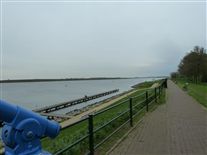
The seaward front of the town consists of two bastions with water in front of them. Between this water and the river (which in the past was part of the sea) there is a glacis, which prevented ships from coming too close to the walls and gave extra protection against enemy fire.
One of the seaward bastions.
A small canal connects the harbour inside the city with the river. The water in the ditch
A wide trench in front of the walls that stopped attackers from reaching the walls easily. Sometimes flooded.
Dry ditch at Blaye and flooded ditch at Calais.
‘is cut of from the river by a dam.
The western dam and the seaward fortifications.
The dike surrounding the polder is connected to the town by two dams. To regulate the water level in front of the two seaward bastions there are sluices in the western dam and near the harbour on the eastern side. On the harbour side a second sluice is made to flood the ditch inside the town.
This was a small ditch running along the inside of the ramparts as an extra obstacle for the enemy once they got inside.
To regulate the water level in the ditch surrounding the town and the covered way
The first line of defence, a covered path in front of the fortifications where soldiers could fire down the glacis.
Covered way (left and foreground) in front of a bastion (right) at Maubeuge, with traverses clearly visible
‘as well as a means to flood the polder a third sluice was made near the only landward gate to the town. Protecting this gate is the only demi-lune
A half-moon outwork that protected the stretch of wall between two bastions. The entrance to a fortress was often protected by a demi-lune.
Demi-lune at Blaye
‘in the fortress.
The inside of a bastion, showing the inner ditch.
In later centuries buildings like powder magazines
A building that housed amunition for a fort or fortress. The powder magazine was usually a very strong building, or an underground cellar, built so as to be protected from enemy fire.
Powder magazine at Brouage. Photo: Michel Plancon.
, bombshelters and, in WW II, blockhouses have been added. These mainly 19th century later additions to the fortress are quite extensive and very well preserved.
The fortress officially lost its military status in 1926. The population of Willemstad asked for the preservation of the fortifications and today the town and its surroundings are a monument.
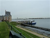
According to me the beauty of this fortress lies in two things: the waterworks with the harbour and the surrounding lands. The harbour is still right near the water and is used intensively, this also adds to the historic atmosphere.
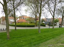
As for the surrounding lands, not only the city but also it’s surrounding lands are preserved. This means that building around the town is mostly forbidden. This makes it possible for the visitor to get a good impression of how things must have looked centuries ago.
View along the curtain wall looking towards a bastion.
The town can be reached by car easily and you are free to visit the fortifications. There are signs along the paths explaining the various features of the fortress.
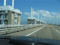
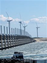
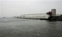
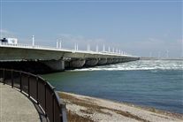
Deltawerken_na.jpg
Delta Works - Click 'Details' for more information
Delta Works:
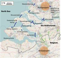
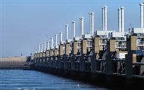
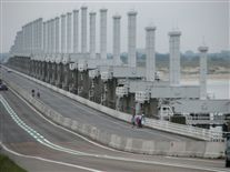
The Delta Works is a series of construction projects in the southwest of the Netherlands to protect a large area of land around the Rhine-Meuse-Scheldt delta from the sea. The works consist of dams, sluices, locks, dikes, levees, and storm surge barriers. The aim of the dams, sluices, and storm surge barriers was to shorten the Dutch coastline, thus reducing the number of dikes that had to be raised.
Along with the Zuiderzee Works, they have been declared one of the Seven Wonders of the Modern World by the American Society of Civil Engineers.
History:
The estuaries of the rivers Rhine, Meuse and Scheldt have been subject to flooding over the centuries. After building the Afsluitdijk, the Dutch started studying the damming of the Rhine-Meuse Delta. Plans were developed for shortening the coastline and turning the delta into a group of freshwater lakes. By shortening the coastline fewer dikes would have to be reinforced.
Due to indecision and the Second World War, little action was taken. In 1950 two small estuary mouths, the Brielse Gat near Brielle and the Botlek near Vlaardingen were dammed. After the North Sea flood of 1953, a commission was installed which had to come up with a plan to research the causes and seek measures to prevent such disasters in future. They revised some of the old plans and came up with the so called "Deltaplan".
The plan consisted of blocking the estuary mouths of the Oosterschelde, the Haringvliet and the Grevelingen. This reduced the length of the dikes exposed to the sea by approximately 400 miles (640 km). The mouths of the Nieuwe Waterweg and the Westerschelde were to remain open because of the shipping routes to the ports of Rotterdam and Antwerp. The dikes along these waterways were to be heightened and strengthened. The works would be combined with road and waterway infrastructure to stimulate the economy of the province of Zeeland and improve the connection between the port of Rotterdam and Antwerp.
Delta law and Conceptual framework:
An important part of this project was fundamental research to help solve the flooding problem. Instead of analysing past floods and building protection sufficient to deal with those, the Delta Works commission pioneered a conceptual framework to use as norm for investment in flood defences.
The framework is called the 'Delta norm' and works as follows:
Major areas to be protected from flooding are identified. These are called "dike ring areas" because they are protected by a ring of primary sea defences.
The cost of flooding is assessed using a statistical model involving damage to property, lost production and a given amount per human life lost.
For the purpose of this model a human life is valued at €2.2 million (2008 data).
The chances of a significant flood within the given area are calculated. This is done using data from a purpose-built flood simulation lab as well as empirical statistical data regarding water wave properties and distribution. Storm behaviour and spring tide distribution are also taken into account.
The most important "dike ring area" is the South Holland coast region. It is home to four million people, most of whom live below normal sea level. The loss of human life in a catastrophic flood here can be very large because there is very little warning time with North Sea storms, and so comprehensive evacuation is not a realistic option for the Holland coastal region.
The commission initially set the acceptable risk for complete failure of every "dike ring" in the country at 1 in 125,000 years. However the cost of building this level of protection was deemed too high, so the acceptable risk was set according to region as follows:
North and South Holland (excluding Wieringermeer): 1 per 10,000 years
Other areas at risk from sea flooding: 1 per 4,000 years
Transition areas between high land and low land: 1 per 2,000 years
River flooding causes less damage than salt water flooding so areas at risk from river flooding have a higher acceptable risk. River flooding also has a longer warning time, making for a lower estimated death toll.
South Holland at risk from river flooding: 1 per 1,250 years
Other areas at risk from river flooding: 1 per 250 years.
These acceptable risks were enshrined in the Delta law, requiring the government to keep risks of catastrophic flooding within these limits and to upgrade defences should new insights into risks require this. These limits are also incorporated into the new Water Law, effective from 22 December 2009.
The Delta Project (of which the Delta Works are a part) has been designed with these guidelines in mind. All other primary defences have been upgraded to meet the norm.
New data elevating the risk assessment on expected sea level rise due to global warming has brought ten 'weak points' to the fore. These are currently being upgraded to meet the future demands. This work is expected to be completed in 2015. For rivers an upgrade is underway, which is expected to be finished in 2017.
Photos_-_1162.jpg
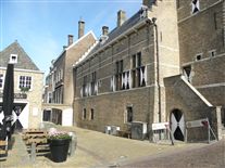
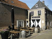
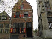
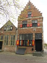
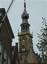
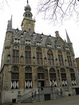
Veere City Hall - lick 'Details' for more information.
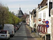
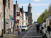
The small city of Veere (population as of 2001[update]: 1,520) is located on the Veerse Meer on the island of Walcheren in Zeeland. The name means "ferry" after Wolfert Van Borsselen established one here in 1281. Veere received city rights in 1355.
"Admiraliteit van Veere" (Admiralty of Veere) was set up as a result of the Ordinance on the Admiralty of 8 January 1488 in an attempt to create a central naval administration in the Burgundian Netherlands. To this was subordinated the Vice-Admiralty of Flanders in Dunkirk. In 1560 under admiral Philip de Montmorency, Count of Hoorn this admiralty was relocated near Ghent and in 1561 the Habsburg naval forces were also moved to Veere.
Veere was the staple port for Scotland between 1541 and 1799. Flemish architects Antonis Keldermans and Evert Spoorwater designed the Grote Kerk, the fortifications, the Cisterne and the town hall. During this period of prosperity, the cultural centre was located at Sandenburgh castle, the residence of the noble Van Borsele and Van Bourgondië families. Court painter Jan Gossaert van Mabuse worked here. The poet Adrianus Valerius lived and worked in the city from 1591. In the 17th and 18th centuries, Veere was a prosperous trading city. There were about 750 houses inside the city walls then, compared to about 300 now. As a result of the damming of the Veerse Gat inlet in 1961, the fishing fleet of Veere moved to a new home port at Colijnsplaat on Noord-Beveland. Today, the main business of the town is tourism.
